THERE are many ways that archaeological sites can be located, and certainly fortune plays its part. By cross referencing written sources and understanding the features landscapes archaeologists may also be able to arrive at conclusions about likely places to dig. Organising a dig, however, can be an expensive and time consuming exercise that involves a lot of people and the approval of the relevant authorities, so it's probably best to have evidence that points to the potential for a successful find.
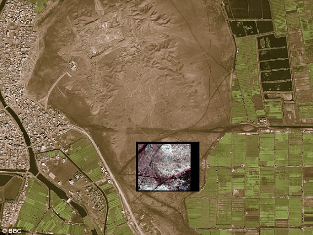
The aerial photograph shown above features part of the excavated perimeter wall of the tomb at the bottom and on the right of the image. Towards the top left and right we get a clearer idea of what the hill looked like before digging began. The image on the right shows the result of a resistivity survey (electrical tomography) indicating the structure of something else beneath the soil, separate from the already excavated tomb.
A very exciting development in archaeology has been the use of LIDAR, or Light Detection and Ranging. This is a new use of satellite technology and near infra-red in order to locate sites.
* Read Bradley, pp. 22-23
* Summarise the methods of remote sensing, geophysics and ground penetrating radar to locate archaeological sites.
* Each of the uncaptioned images below shows other more traditional ways of locating archaeological sites. Click on each image to learn about the method of locating that it shows, and summarise an explanation of this. You should copy and paste appropriate images and diagrams to complement your notes.
Image 1
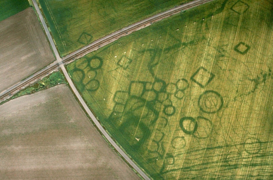
Image 2
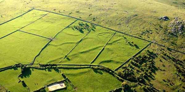
Image 3
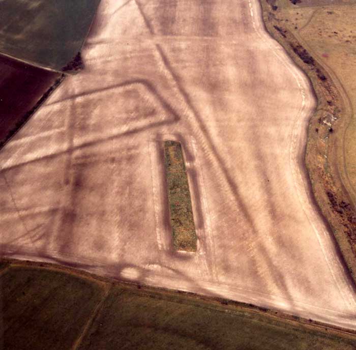
Image 4
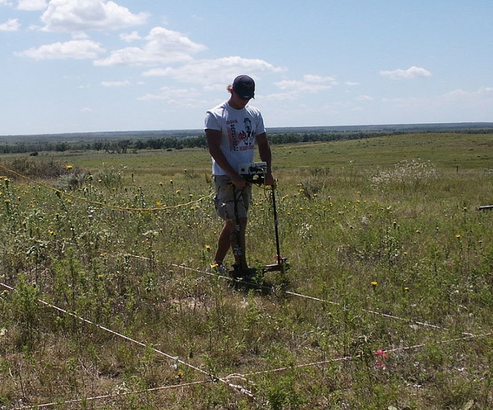
Image 5
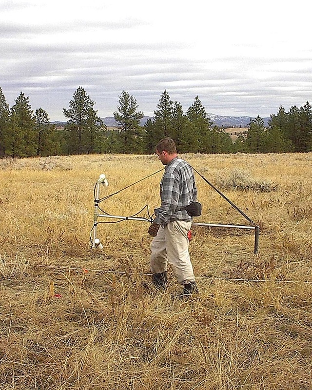
Image 6
* EXTENSION: Read the article on Lidar from the BBC by clicking here.
* Watch the short interview with Sarah Parcak, an archaeologist who has used Lidar in Egypt, below.
* After reading the article and watching the interview, write a list of the advantages and disadvantages of using Lidar.
* Watch the short interview with Sarah Parcak, an archaeologist who has used Lidar in Egypt, below.
* After reading the article and watching the interview, write a list of the advantages and disadvantages of using Lidar.
